AHO WORKS RESEARCH 2012
Urbanism and Landscape
Water-based urbanism, that is, the design of cities around the role and dynamics
of water, has been a powerful urban impetus in many parts of the world. As a
consequence of the location of cities along major rivers, on seacoasts, and in
inland and coastal deltas, water urbanism is indeed a predominant part of the
history and current status of many cities. However, water urbanismhas changed
and continues to face pressures to evolve.
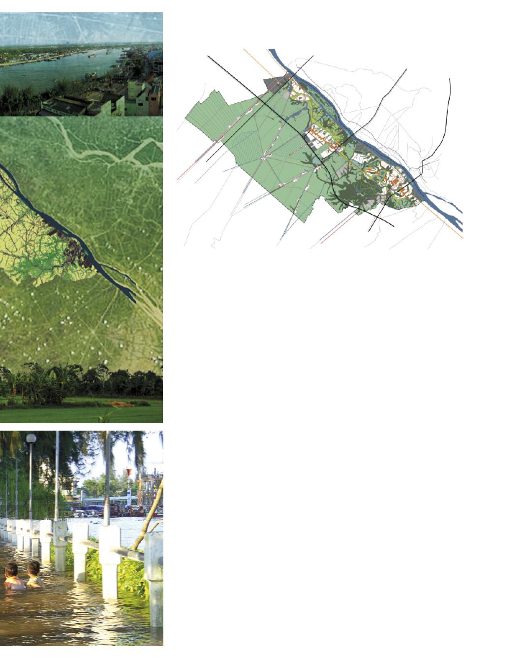
Strategically situated in the heart of the Mekong Delta, Cantho (140,200
hectares) covers a linear strip along the Hau River (the lower branch of the
Mekong). The city developed over the last three centuries in close relation to the
dynamics of the region’s liquid landscape. Traditionally, the spatial structuring
of the territory drew its identity from overlapping systems of water and road
infrastructures, with settlements dispersed over the productive landscape of
lowland paddy and highland orchards atop dikes or riversides. This organized
dispersal is tied to the intricate balance and interdependent structure of water
and productive land, permeable and impermeable surfaces — all organized by
hydraulic systems for water management and soil stabilization. An indigenous
landscape logic of minute topographical differences (corresponding to differ-
ent levels of inundation) orchestrates distinct land uses and regulates balances
between built and open landscapes.
In the past decade, huge investments in infrastructure have beenmade to improve
the city’s role as a regional centre, and to increase connectivity in a triangle with
Ho Chi Minh City and Phnom Penh (Cambodia). A revised masterplan is neces-
sary to meet the new challenges of the Cantho’s regional role, respond to rapid
and substantial urbanization pressures, and the dramatic predictions of climate
change. One of the main questions is: How can Cantho simultaneously keep its
identity and move to higher levels of productivity (of its agriculture and economy
in general)? The revised masterplan was developed after extensive fieldwork,
meetings with local stakeholders and work together with SIUP.


